
ArcGIS, an advanced and versatile geographic information system (GIS) software, empowers users to create intricate maps, conduct comprehensive data analysis, and seamlessly share their discoveries. With its extensive applications across various domains, ArcGIS has become an essential tool for organizations worldwide, including here at Hollaway.
By harnessing ArcGIS's unique capabilities and flexible licensing options, businesses can integrate location-based analytics into their operations, revolutionizing their decision-making processes. Through the amalgamation of innovative technologies and accessible tools, ArcGIS plays a pivotal role in elevating spatial problem-solving to new heights.
ArcGIS is a feature-rich GIS software that equips users with a multitude of tools and functionalities. Whether you're creating maps, analyzing complex datasets, or collaborating with colleagues, ArcGIS provides a comprehensive platform for all your spatial needs. Its versatility enables seamless integration with existing systems and databases, facilitating a smooth transition into a geospatial framework. From simple visualizations to sophisticated spatial analyses, ArcGIS offers a user-friendly interface suitable for both novices and seasoned GIS professionals alike.
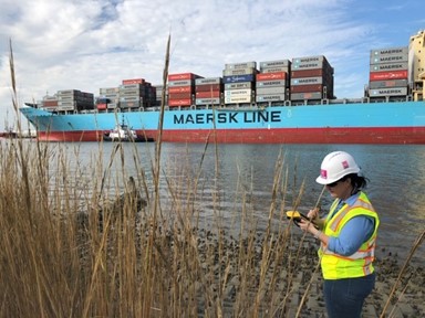
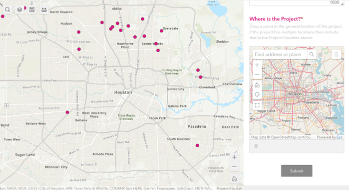
In the realm of infrastructure development, ArcGIS proves indispensable. By incorporating location-based analytics, organizations involved in infrastructure projects gain valuable insights that drive effective decision-making. ArcGIS enables the visualization and analysis of data related to transportation networks, utility systems, and urban planning. Here at Hollaway, our environmental scientists use ArcGIS to evaluate the suitability of locations for new developments, considering factors like population density, proximity to amenities, and environmental constraints. With ArcGIS's robust capabilities, Hollaway assists many infrastructure stakeholders by streamlining project planning, identifying potential challenges and optimizing resource allocation.
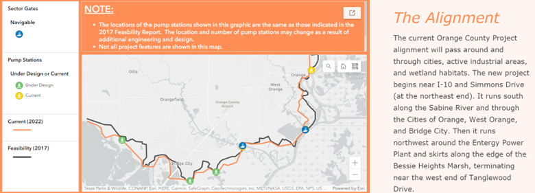
The rapid advancement of technology has revolutionized the way we approach spatial problem solving. ArcGIS, with its user-friendly interface and accessible tools, empowers professionals from various industries to tackle complex spatial challenges. In the realm of infrastructure projects, ArcGIS's sophisticated spatial analysis capabilities enable stakeholders to make data-driven decisions. By leveraging geospatial data, organizations can better understand the spatial context of their projects, identify potential risks, and design efficient solutions. From analyzing traffic patterns to determining suitable locations for utility infrastructure, ArcGIS plays a crucial role in optimizing infrastructure development.
ArcGIS, with its versatility, robustness, and accessibility, continues to revolutionize spatial analysis and problem-solving across various industries. In infrastructure projects, ArcGIS empowers stakeholders to make informed decisions by leveraging location-based analytics. By harnessing the power of geospatial data, organizations can optimize resource allocation, streamline project planning, and minimize potential risks. As technology advances further, ArcGIS will continue to be at the forefront of spatial analysis, enabling professionals to unlock new insights and drive innovation in their respective fields. ArcGIS proficiency is just one of the many expertise Hollaway has to offer.